Signed in as:
filler@godaddy.com
Signed in as:
filler@godaddy.com
Your property corners are actually iron rods placed in the ground by the original sub-divider of the property. We will come out to your property and find these iron rods and verify that they are correct according to your deed. Then stakes will be placed along your property lines between the property corners. This is a must have service if you are putting up a fence.
Your property and all improvements including but not limited to the house, driveway, decks, sheds, garages, fences, pools, walls, etc. will be located and shown on a plat. This plat will be reviewed and certified by a Georgia Registered Land Surveyor. Your plat will also meet all the requirements of the Georgia Plat Act and will be recordable at the County courthouse if you deem necessary.

The county or city where your property is located will require a site plan if you are doing any sort of building such as a house, an addition, or a pool. The site plan starts with a boundary survey and may include other items such as topography (elevations or contours) and trees. It all depends on what the county or city your property is located in requires.

This type of survey starts with a boundary survey of the entire tract of land. A lot split divides one tract of land into two tracts or lots. A subdivision on the other hand divides one tract of land into more than two tracts or lots. The survey plat will then need to meet the county or city requirements in order to be approved. Once it is approved, deeds may be written in order to transfer title to another party.

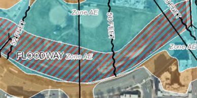
If you are paying for flood insurance, then you may want to consider getting a FEMA Elevation Certificate to reduce or even make you exempt from paying flood insurance. The certificate states the existing elevation of your home and compares it to the existing floodplain to determine if your home is higher or lower than the flood elevation determined by FEMA.

This type of survey is extremely detailed. It provides the lender and title insurance company with the information needed to insure the title to the land.

This is a common survey that shows conditions that have previously been built. The county or city will usually require this type of survey after a site has been built in order to make sure that it was built as engineered.

This service is provided to contractors to assist them in the layout of new structures such as parking lots, building, etc. Construction staking by a professional land surveyor can eliminate errors on the construction site and speed up construction schedules.
These types of surveys are required by counties and city in order to get a license to sell beer, wine, or alcohol.
Newnan, Ga